
Ready
Map roads and parking for bumps, ruts and where water will stand
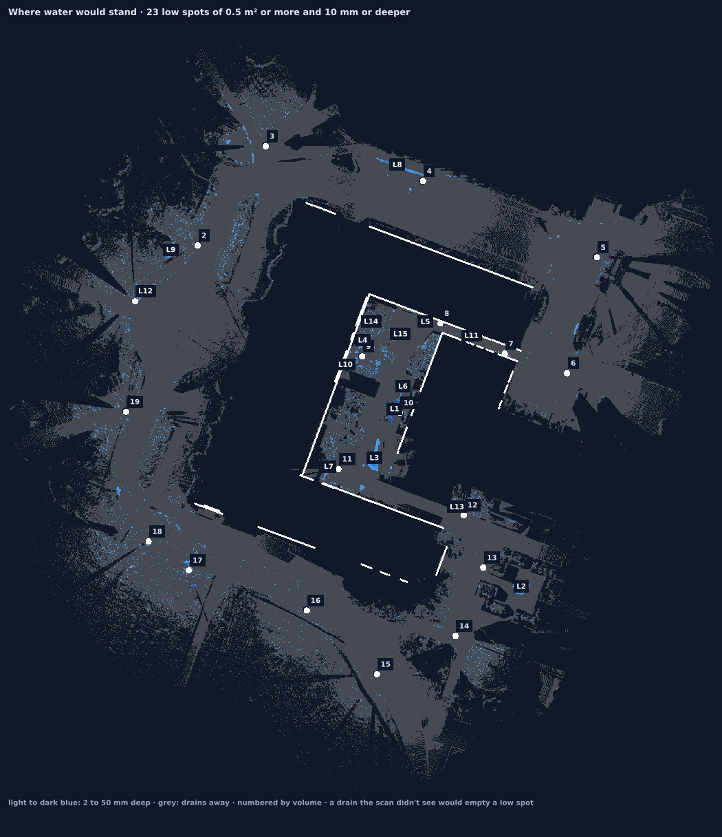
The scans become a 10 cm height grid of the ground, cars left out. From it: the heights with contours, the bumps and dips against their surroundings, and the places water would collect. For the demonstration, we scanned the administration building at the University of Idaho.
1 · A real result
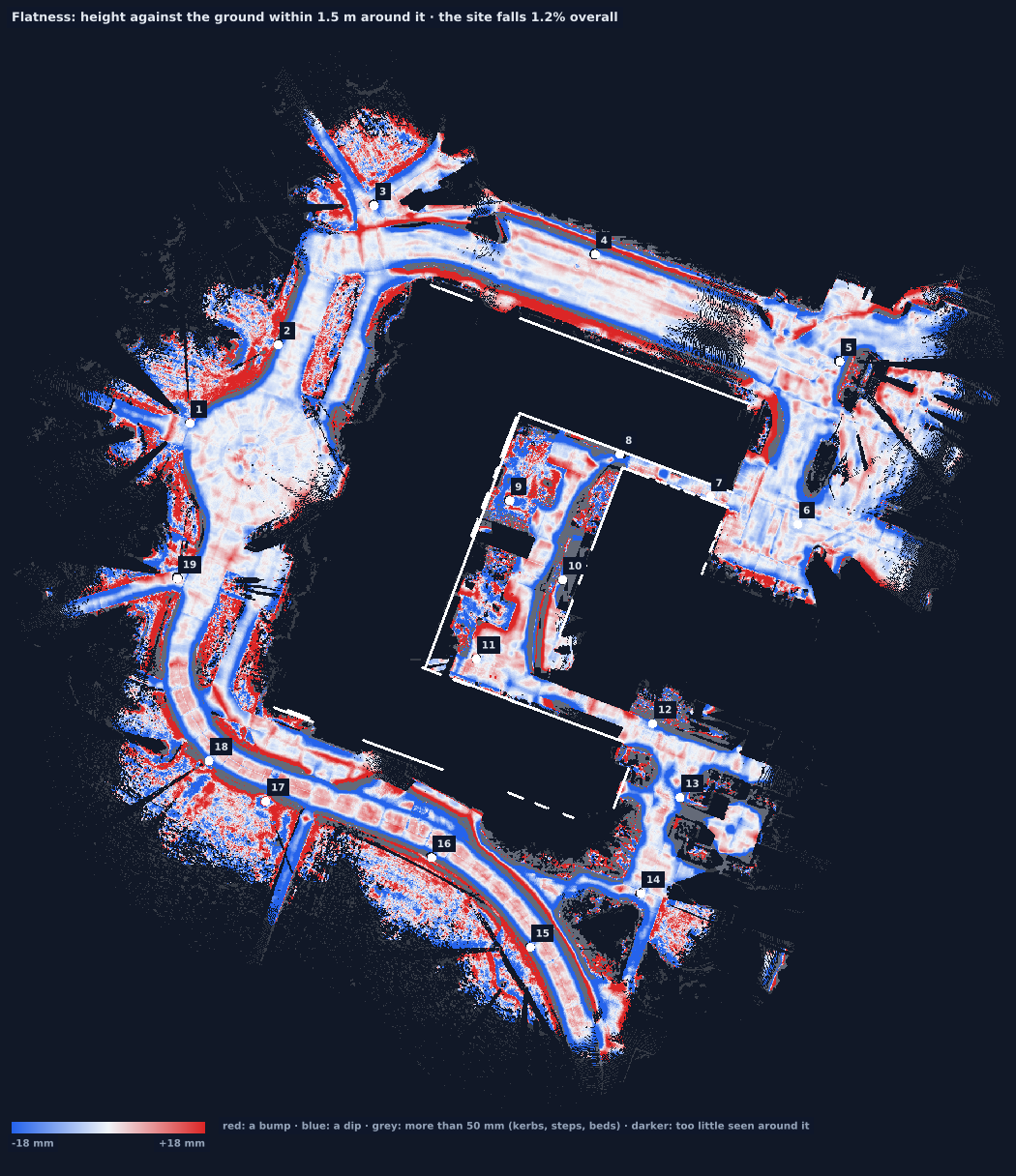
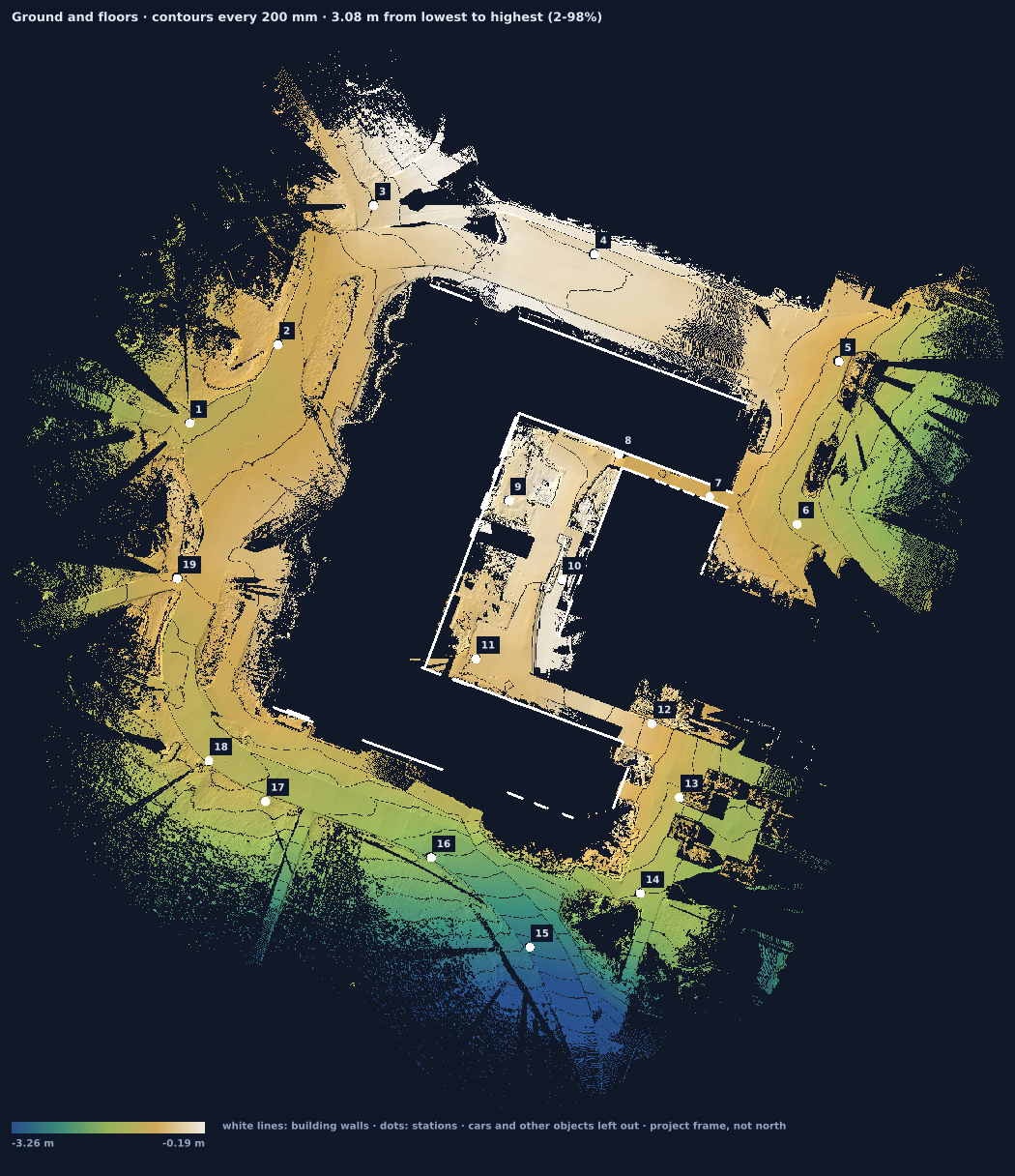
1.2%overall fall of the site
23low spots of 0.5 m² or more, 10 mm or deeper
74 litreslow spot L8, on the road by station 4: 5.6 m², 28 mm deep
10 cmgrid, over about 10,000 m² seen
Not every low spot is a puddle. The deepest here (L1, 203 mm) is a planting bed in the courtyard. The report lists each one with its position, so someone can check it on site.
2 · What you receive
- The three maps above, a table of low spots (position, area, deepest point, volume) as CSV, and the low spots on the DXF plan.
- The height grid itself, to compare with a later visit: cut and fill between the two.
- Cross-sections along any line you choose (see heights and sections).
Open the full report for this site.
3 · What it takes on site
- Stations along the surfaces you care about, about every 15 to 25 m; ground farther than 30 m from every scanner is left out, as it is seen too flat to be trusted.
- Cars and bins hide what is under them: they are recognised and left out, and the ground under them stays unknown.
- The analysis takes about half a minute on a laptop for this 19-station site.
4 · How sure
- Water goes where the scan couldn't see. A drain, a grate or a gap in the scan lets water out; the map treats unseen ground as an outlet. Check drains on site.
- Repeatable, not yet calibrated. Not yet compared with a level run or a total station on this site.
- Volumes: the cut-and-fill arithmetic was checked on this site's real height grid with a planted 18.85 m³ pile and a 2.40 m³ pit (it reported 18.84 and 2.40 m³). That checks the arithmetic, not two real visits; stockpiles stay Close until a real pile has been scanned twice.
- Not a stamped survey. Topographic deliverables that need a licensed surveyor still do.