North Idaho Labs

The visit

You start with a mission. The AI suggests a first scan. After that scan, the result is where to stand next, drawn on the view you already have, so the mission can be answered. On the administration building a mission might be the wall a new opening has to meet, the parapet a lift has to reach, the water on the walks, or one map for the crew.

One mission, as the person sees it

This is a replay. A crew set the administration building's 19 stations; the bridge planned its spots afterwards from each station's own points, and the agent's replies are scripted runs on the simulator.
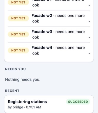
The field app's mission card for the administration building: the sentence as the goal, what done means, and four questions, each on one line with its state.
The sentence. The person says what the job has to answer; the mission card holds it, and each question gets one line.
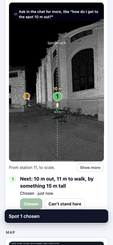
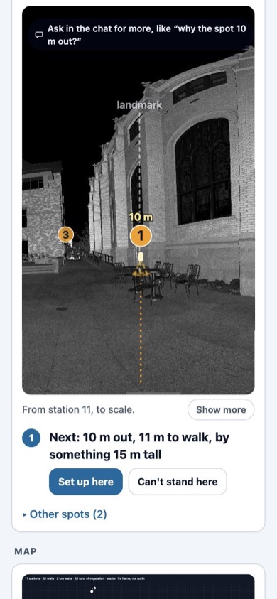
Station 11's view of the administration building with the next station drawn as a tripod at its real size, the walk to it, and the landmark beside it.
The next station. Drawn into the view the person already has: the tripod the size it will be there, the walk to it, and what it stands beside.
The same administration building view after the person chose the spot: the tripod turns green and the card says chosen.
The move. The person chose the spot, or would have ruled it out and said why. Either way it is one line in the record, and the agent reads it there.
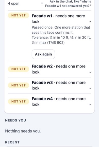
The administration building mission card at nine stations with the first question open: not yet, because the face passed once and needs one more station that sees it, and the tolerance the job set.
The answer that waited. At nine stations the first face had passed once, which is not an answer yet; the card says what it is waiting for, and the tolerance the job set.
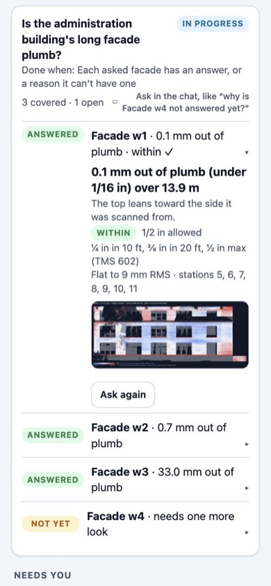
The same administration building question at eleven stations: answered, within the tolerance, with the bridge's words and the heat map of the face.
The answer. Two stations later the face had been seen again and agreed, and the line changed by itself, with the picture behind it and the call against the tolerance.
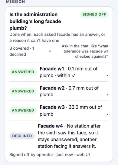
The administration building mission card after sign-off: three questions answered, the fourth declined with its reason, and who signed.
The sign-off. Three faces answered. The fourth never came back into view, so it is declined with that reason rather than guessed. Nothing is open, and the person signs once.

The wall a new opening has to meet

Is the long facade plumb, within a quarter inch in ten feet?

The suggestion is a first scan with the wall in view. Station 3 is that scan. Drawn on it is where to stand next: on the road, about 40 m along the wall, past the shelter.

Where to stand

On the road, about 40 m along the wall, past the shelter.

Station 3's view. The long wall is marked seen, the shelter is the landmark, and the next setup is drawn on the road past it.
Set up on the road, about 40 m along the wall, past the shelter.

From that spot

Nothing stands in front of the wall.

Station 4's view of the long wall, marked seen. Nothing stands in front of it.
From the road. The outline stops where the wall turns.

4.1 mm out of plumb (3/16 in) over 14.6 m. The top leans toward the side it was scanned from. The tolerance gives no allowance for 14.6 m of height. Flat to 7.6 mm RMS. Stations 3, 4, 5, and 6 saw it. The plane runs 44.4 m.
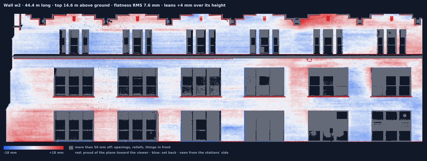
Heat map of the 44.4 m plane. Red stands proud of the plane. Blue sits back.
The 44.4 m plane. Red stands proud. Blue sits back.

Open the walls

The parapet, and how high the lift goes

How tall is the wall, from the ground at its foot?

The suggestion is a first scan with the bays in view. Station 17 is that scan. The top is still ahead, and drawn on the picture is where to stand next: on the road, about 30 m past the rail.

Where to stand

On the road, about 30 m past the rail.

Station 17's view. The arched wall is marked seen, the rail is the landmark, and the next setup is drawn on the road past it.
Set up on the road, about 30 m past the rail.

From that spot

The top of the wall is in view.

Station 16's view of the arched wall, marked seen. The top of the wall is in view.
From the road. The outline is the arched bays.

16.2 m, from the ground at its foot to the parapet the scan saw. Stations 15, 16, 17, and 18 saw it. The wall runs 15.4 m.
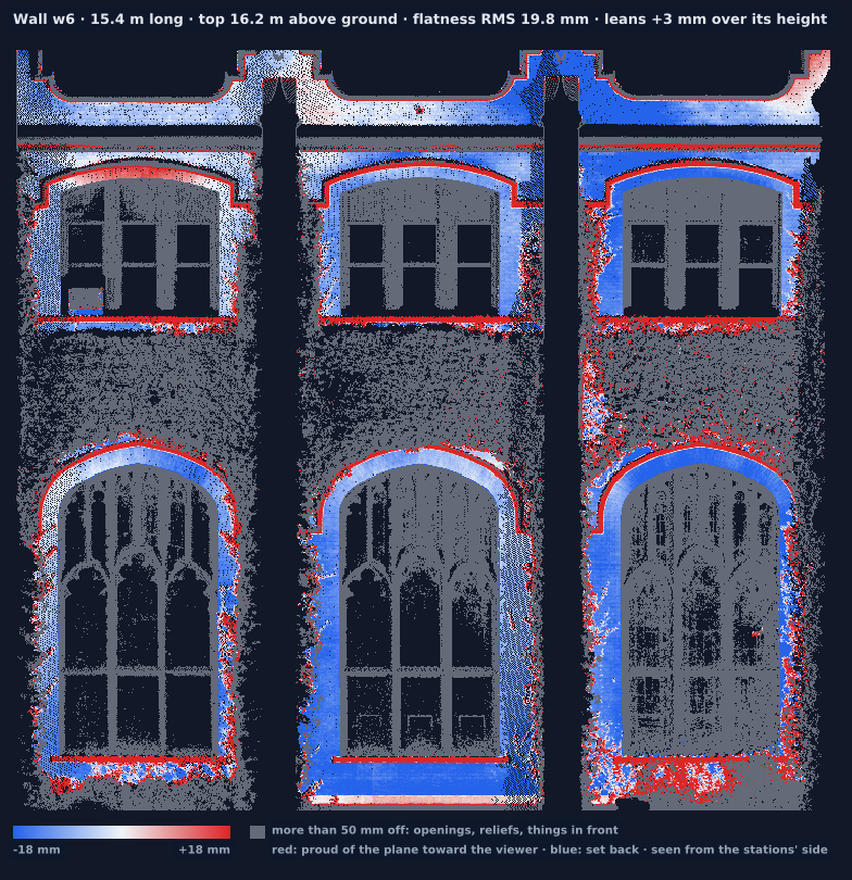
Heat map of the 15.4 m wall. Grey is the openings. Its top stands 16.2 m above the ground at its foot.
The 15.4 m wall. Grey is the openings.

Open the heights

The walks, and the water already there

Where will water stand in this lot?

The mission is the water. The scans the other missions asked for already hold the ground. Crowns stand up. Gutters sit down. The road by station 4, the setup for the long wall, is one of the low places.
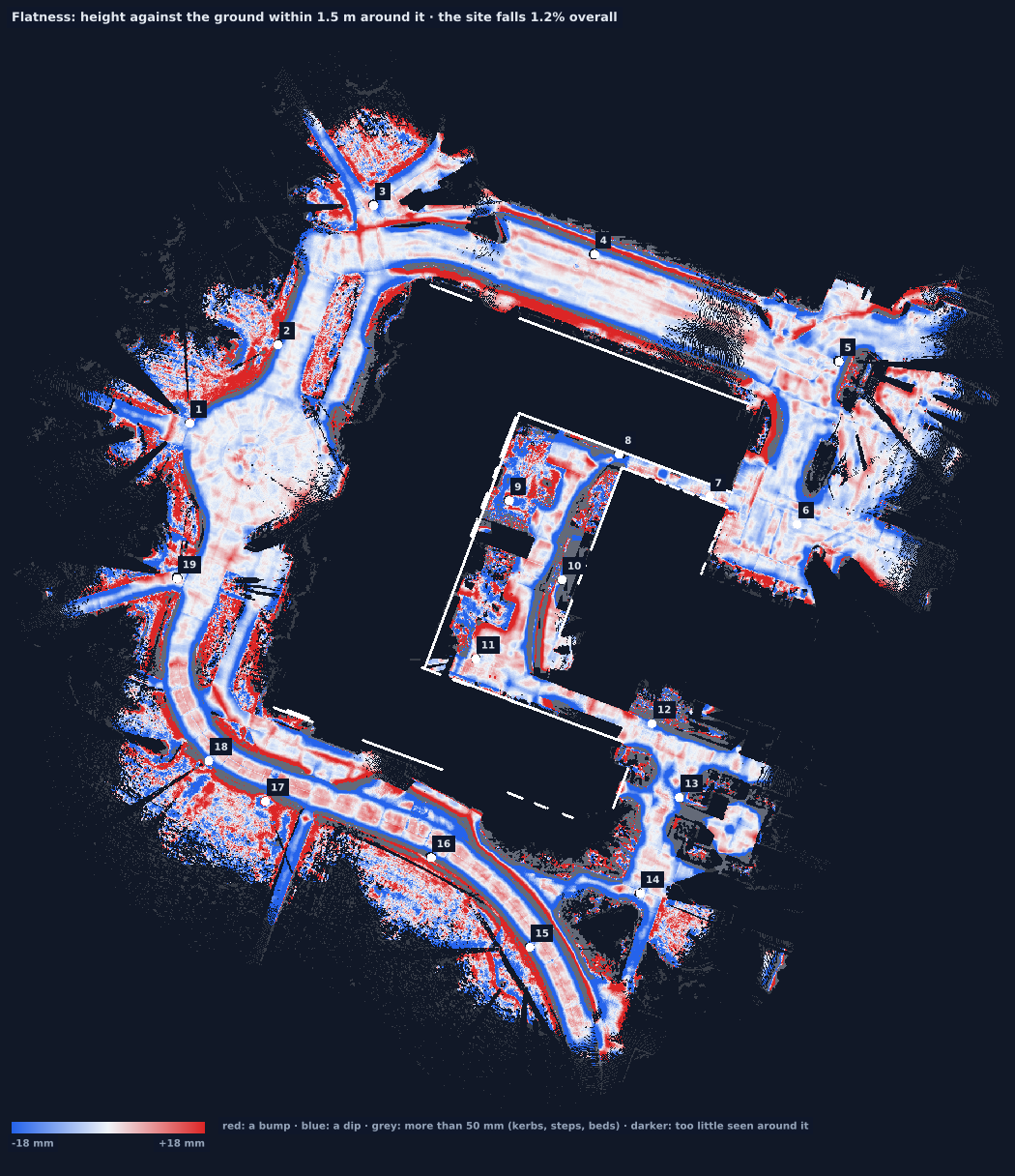
Plan of the site coloured by height against the ground within 1.5 m: road crowns in red, gutters along the road edges in blue.
Crowns in red, gutters in blue. The slope of the site is taken out, so a bump shows as a bump.
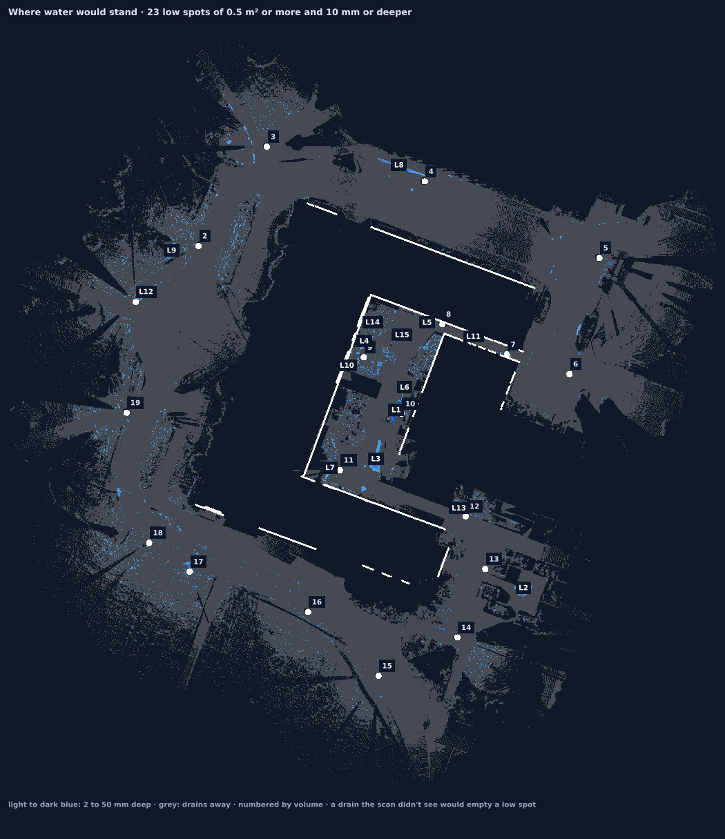
Plan of the site with places where water would stand shaded blue and numbered by volume.
Where water would stand before spilling over the ground around it, numbered by volume.

23 places of 0.5 m² or more, 10 mm or deeper. On the road by station 4, one of them holds 74 litres: 5.6 m², 28 mm deep. The deepest, 203 mm, is a planting bed in the courtyard. The ground falls about 3 m across the site.

Open the ground

One map for the crew

Give me the whole site in one map.

The mission is one map. Each mission placed a station. The mason, the windows, and the paving are looking at those stations in one frame.
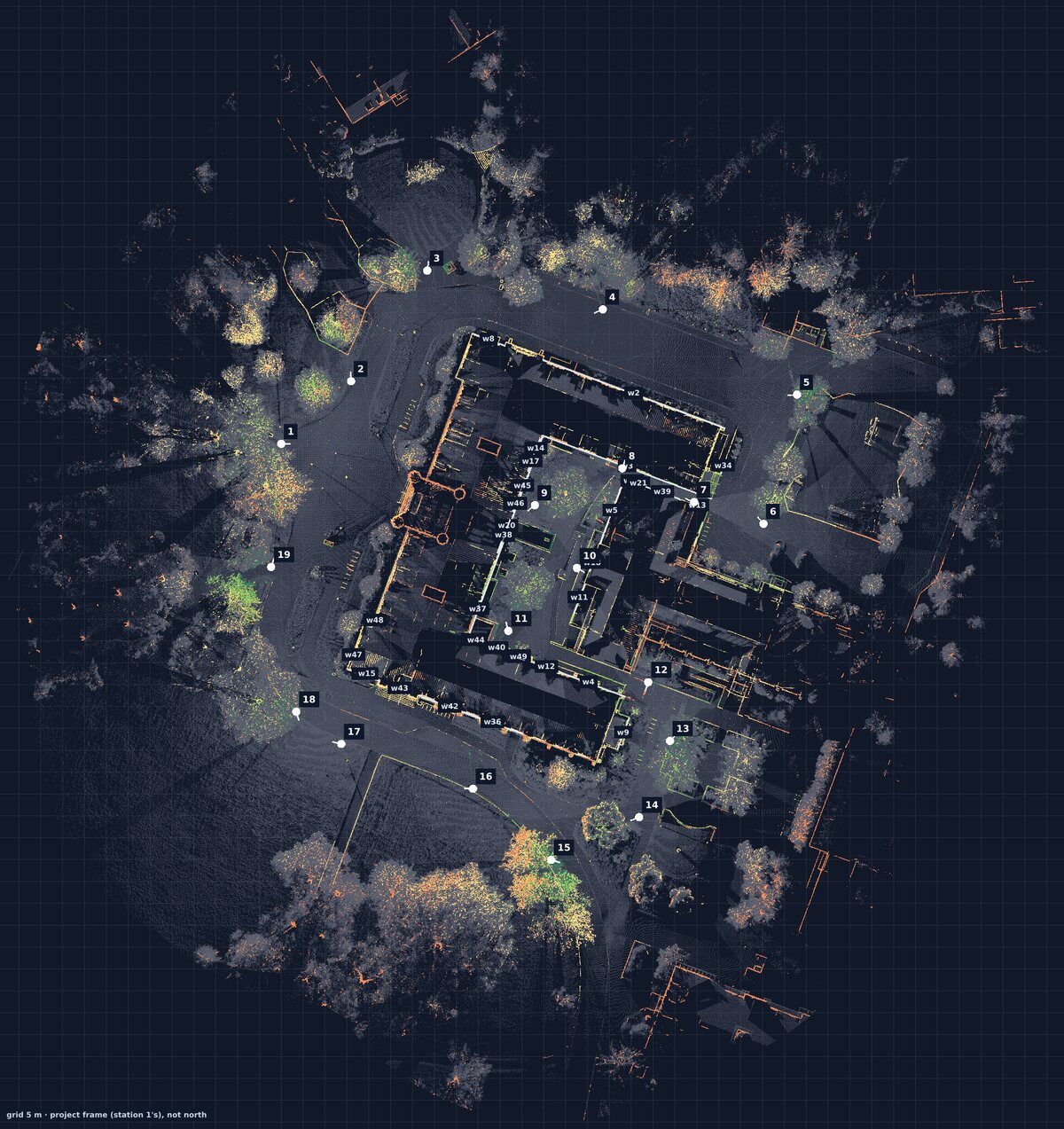
Top-down view of all 19 registered stations, with numbered stations and wall labels.
All 19 stations in one frame, seen from above.

The most any two overlapping stations disagree is 22 mm. The map is redrawn after every station.

Open the site record

The first mission the agent runs end to end, from the sentence to the sign-off, is the scanner's next build.

Start a scan